

DON'T BE ALARMED: Members of public warned about low-flying plane over Tipperary

ALERT
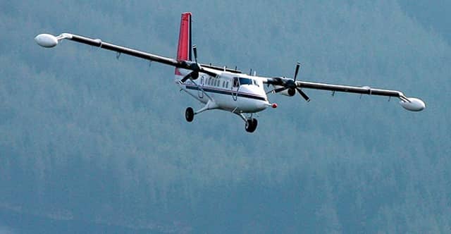
Residents and farmers in parts of Ireland are being warned that a Tellus geophysical survey plane will be operating from September until the end of the year.
The latest phase of the survey will see the aircraft flying from September 2020, until the end of the year, weather permitting, over counties Laois, Kilkenny, Tipperary and Waterford, and neighbouring parts of Kildare, Carlow, Offaly and Cork.
The Tellus survey is a national programme to gather geochemical and geophysical data across Ireland – in other words, to examine the chemical and physical properties of our soil, rocks and water.
Tellus is undertaken by Geological Survey Ireland and is funded by the Department of Communications, Climate Action and Environment. All data from Tellus is made available free of charge online.
Tellus involves two types of surveying – airborne geophysical surveying using a low-flying aircraft and ground-based geochemical surveying of soil, stream water and stream sediment.
For up to date information and the planned weekly flight schedule, please visit www.tellus.ie.
The aircraft will fly at a low level of 60 metres over rural areas (approximately eight times the height of a standard two storey house), rising to 240 metres over urban areas.
The sound of the plane is similar to that of a passing lorry and it may startle sensitive livestock, such as horses, pedigree cattle, sheep-in-lamb and poultry flocks. The speed of the aircraft is about 216 km/h or 130 mph.
If you have any concerns about the survey, particularly if you own sensitive livestock and you would like to be kept informed of latest flight plans in your area, you can contact the Tellus Freephone information line on 1800 45 55 65 or visit www.tellus.ie.
You can also follow Tellus on twitter, @TellusGSI