

Tipperary braces itself for Tropical Storm Ophelia
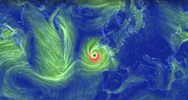

Schools throughout Tipperary will remain closed tomorrow as Tropical Storm Ophelia is expected to wreak havoc when it hits Irish shores in the early hours of the morning.
The Department of Education and Skills have confirmed that all Primary, Secondary and Third Level Schools are to close.
As at 8:15 pm this evening the following schools confirmed that they will close on Monday.
Ballina and Boher NS, St Annes Killaloe
Ballytarnsa - Little Flower NS
Bright star Montessori & After school, Gaile
Cappawhite NS
CBS Secondary Thurles, Colaiste Mhuire Thurles
Clerihan
Colaiste Dun Iascaigh Cahir.
Colaiste phobal Roscrea
Corrigan National School.
Fethard Secondary School
Glengoole NS.
Holycross NS
Inch NS
Knockanrawley Childcare Daisychain Tipperary Town
Loughmore NS
Moycarkey NS
Naionra Chaisleain Nua Newcastle
New Inn boys and girls school
New Inn Girls School
Newcastle NS
Newport Convent Primary and Boys National School
Our Lady of Mercy and Cahir boys school.
Pouldine
Presentation Ballingarry
Rahealty National School
Rearcross NS
Rosegreen
Scoil Angela Ursuline primary
Scoil Aonghusa Cashel.
Scoil Chormaic Cashel
Scoil Mhuire Greenhills Carrick on Suir
Scoil Mochaomhog Naofa Two Mile Borris
Scoil Ruain Killenaule.
St Ailbes Tipperary Town.
St Josephs in Borrisoleigh
St Mary's Secondary Lisvernane National School
St. Anne's and The Abbey secondary schools in Tipperary town
The Deanery School, Cashel
Thomastown National School.
Thurles CBS
Ursuline Secondary Thurles
Meanwhile, a spokeswoman for Shannon Airport said: “Shannon Airport will remain open tomorrow, Monday 16th October. The safety of our passengers and staff is our first priority. We would ask passengers to contact their airline with regard to updates on schedule changes for tomorrow. However, at this point we are aware of the following flight cancellations: Aer Lingus Regional EI3675/3672 from and to Edinburgh and EI 3639/3638 from and to Birmingham, and London/Heathrow EI381 and EI384 with Aer Lingus.
“Airlines will continue to advise passengers of schedule changes and we advise intending passengers to check the status of their flight with their airline before travelling to the airport tomorrow.
We will continue monitoring the situation throughout the day and live flight information is available on www.shannonairport.ie or on the Shannon Airport App. We will post airport operational updates tomorrow on our social media channels (Twitter and Facebook) as we become aware of them but, again, we would encourage passengers to check with their airline.”
University Hospital Limerick has said that due to the weather warnings issued by Met Eireann as a result of storm Ophelia, UL Hospitals Group is cancelling all outpatient appointments, day surgery and elective procedures in University Hospital Limerick, University Maternity Hospital Limerick, Nenagh Hospital, Ennis Hospital, Croom Orthopaedic Hospital and St John’s Hospital on Monday 16th October. Patients are advised not to travel to the hospitals unless absolutely necessary.
Injury Units will remain open in Ennis and Nenagh Hospitals from 8am to 8pm and in St John’s Hospitals from 8am to 6pm and the Emergency Department in UHL remains open 24/7.
All patients whose appointments have been cancelled will be contacted to reschedule.
In the interest of the safety of the UL community the University of Limerick has announced that it will be closed tomorrow as a result of a code red weather warning in the area.
All public spaces will be closed including the University Arena, the University Concert Hall and all public walk ways throughout the campus.
All on campus residents will be instructed to stay indoors for the duration of the storm and will be supported by security teams tomorrow.
Flood defences have been put in place on the banks of the River Shannon through the UL campus as a preventative measure.
Tipperary County Council's Emergency Management Team has also met to plan for the possible affects of the storm.
A Status Red weather warning with gusts of over 130km per hour are expected.
The Tipperary County Council warning states:
"Mean wind speeds between 65 and 80 km/h with gusts between 110 and 130km/h are expected. The winds have potential to cause structural damage and disruption, with dangerous marine conditions due to high seas and potential flooding.
"(Current forecasts predict, in the South and along the East coast, wind values are likely to be in the high end of the orange scale but all parts of the country will be at risk).
Key Public Safety & Information Messages (as advised by the National Directorate for Fire and Emergency Management):
*All unnecessary travel should be avoided on Monday while the storm is passing.
*Don’t travel in Red level warning areas during the height of the storm unless absolutely necessary, and take due care if travelling in all other areas. Listen to local radio and national media broadcasts regarding the current weather situation.
*High seas predicted, the public are advised to stay away from coastal areas during this period.