

ALERT: Met Éireann's Irish weather forecast for the coming week is in...

Met Éireann's Irish weather forecast for coming week is in...
Tuesday morning will be mainly dry but outbreaks of rain and drizzle in the south will gradually spread northeastwards through the morning and afternoon.
The rain will become heavy at times, particularly in the south. Mild and humid with highest temperatures of 13 to 17 degrees in moderate southeast winds, occasionally fresh and gusty.
OVERVIEW: Mild with further spells of rain, heavy at times. Some brighter showery interludes too.
Tuesday night will be a wet night, with spells of rain, heavy and possibly thundery at times.
The rain looks set to be heaviest in the south and southeast, with spot flooding.
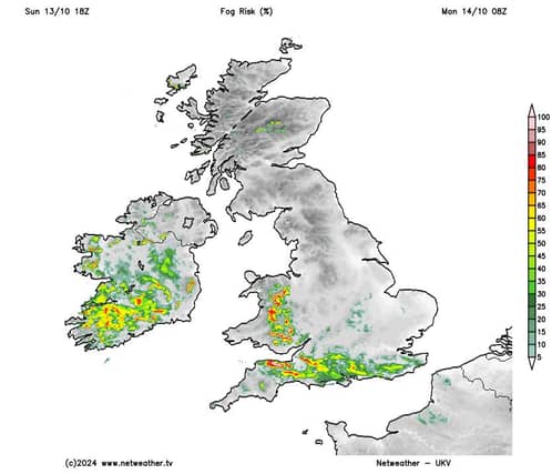
There'll be hill and coastal mist and fog too. Very mild and humid with temperatures not falling below 11 to 13 degrees, in moderate, occasionally fresh southeast winds, decreasing mostly light to moderate later.
Wednesday will bring more rain, heavy and possibly thundery at times, with spot flooding. There'll be fairly widespread mist and hill and coastal fog for a time too.
A clearance to sunshine and a few showers will move in the southwest in the early afternoon will gradually extend northeastwards to most parts.
Highest temperatures of 15 to 18 degrees in light to moderate southeasterly winds, veering south to southwesterly.
Any remaining rain will clear from the northeast early on Wednesday night and the rest of the night will be dry in many areas with clears spells and a few patches of mist and fog.
However, there'll be showers in some western and southern areas, some heavy. Lowest temperatures of 8 to 11 degrees in light to moderate southerly breezes.
Thursday will be mild with bright or sunny spells and some scattered showers, with these most likely in the south and west, some heavy, with the slight chance of thunder.
Highest temperatures of 14 to 17 degrees in light to moderate southerly breezes.
Apart from a few scattered showers in the west and north, it'll be dry for a time on Thursday night with clear spells.
However, it'll become increasingly cloudy from the west, with rain moving in across the western half of the country.
Lowest temperatures of 9 to 12 degrees in mostly moderate southerly winds, increasing fresh to strong in coastal parts of the west and south.
The rain will spread eastwards on Friday morning, so it'll be cloudy and wet for a time across the eastern half of the country. However a clearance to sunshine and scattered showers will follow from the west, a few heavy.
Highest temperatures of 12 to 15 degrees with moderate to fresh southerly winds, veering southwesterly and decreasing light to moderate.
At the moment it looks like there will be further spells of rain or showers over the weekend and it'll be windy at times, but it'll be mild.